Muskoka’s Main Street: 150 Years of Courage and Adventure Along the Muskoka Colonization Road
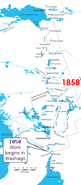
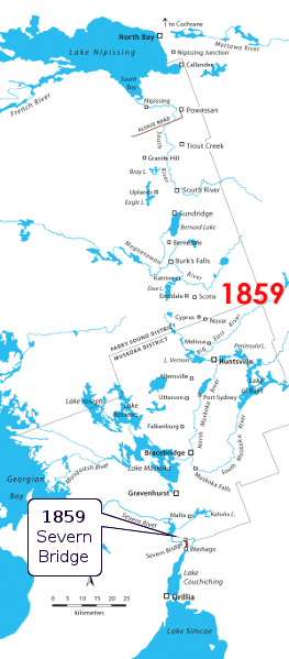
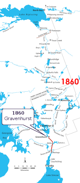
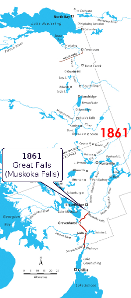
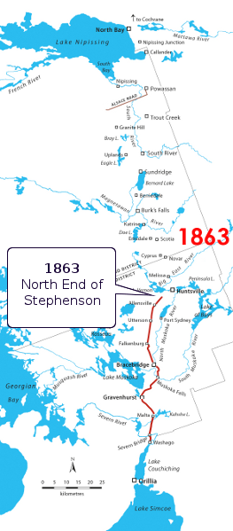
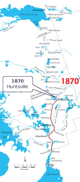
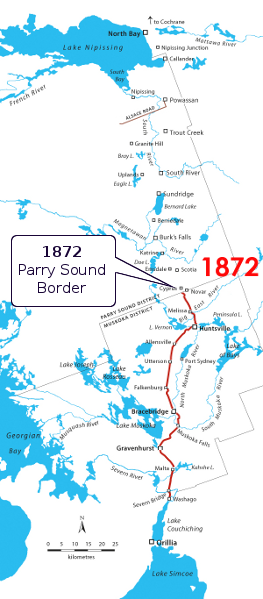
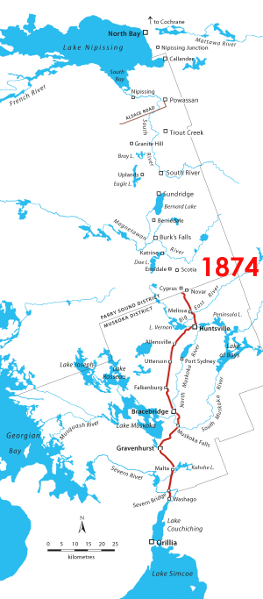
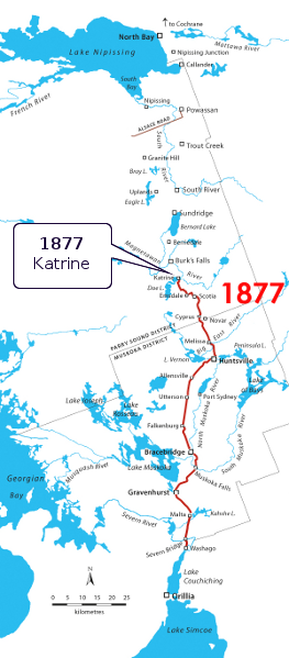
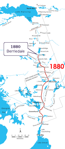
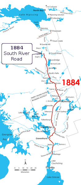
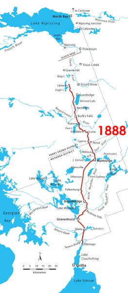
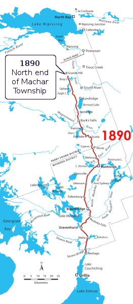
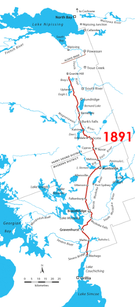
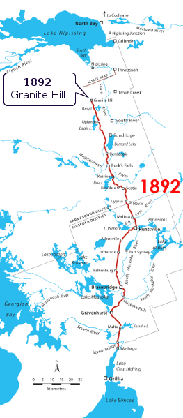
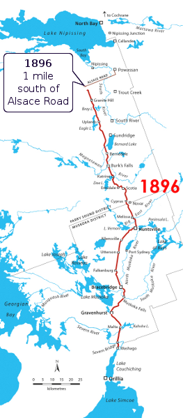
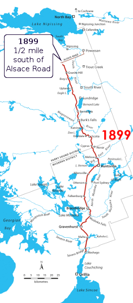
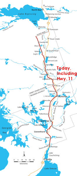
Evolutionary Map
Use this slideshow to see the evolution of the Muskoka Colonization Road, at the pace it was built between 1858 and 1899. The slides will begin to play automatically as soon as the page is loaded; you can use the pause button at the centre top, or the arrow buttons at the left and right, to stop the show and/or move forwards and backwards.
If you want to travel the road as it exists today, use the Google Maps version, which will guide you and point out places of interest along the way.